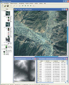
Barista is a low-cost software system for data processing and metric geo-information extraction from high-resolution satellite imagery (HRSI).
It was created from a CRCSI research project at The University of Melbourne. Barista’s strength is that it offers easy-to-use, commonly needed spatial information extraction tools which are currently available only in high-end specialist digital photogrammetric workstations. This makes it an ideal tool for practitioners and non-specialists seeking to extract spatial information from HRSI, especially from single images from the Ikonos, Quickbird, SPOT5 and ALOS satellites.
It has been licensed for use to the multi-national company Infoterra and is currently being trialled by Pasco Corporation, the Australian Department of Defence, SKM, NSW Land and Property Management Authority and the Government of Bhutan.
Of particular note is the implementation of Barista in Geoscience Australia business processes to improve threefold their production rates for orthoimage generation from ALOS, PRISM and AVNIR imagery.


