Impact
Our Impact
The impact achieved by the CRCSI from its activities since 2010 will be AU$1.07 billion, meaning that for every AU$1 invested by the CRCSI there will be a resulting benefit of AU$3.13.
Between 2010 and 2018 the CRCSI delivered a research impact of AU$461 million from AU$322 million in costs.
Much of the benefit results from the CRCSI research delivering outcomes that reduce costs to end users either in collection, processing, delivery, maintenance or usage.

Some examples of CRCSI impact are below:
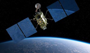
Positioning Breakthrough (2012)
CRCSI announced a world-first in integrating GPS and Chinese BeiDou satellite signals to demonstrate the benefits in Australia of precise,...
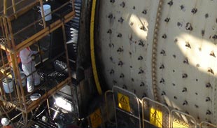
Laser Scanning Applications (2014)
Scanalyse Pty Ltd commercialised laser scanning technologies globally; won an Australian Eureka Award; and has been purchased by global company...
Environmental Monitoring (2011)
CRCSI Feature Extraction project tools assisted Geoscience Australia to produce the Australian Geographic Reference Image, providing an important foundation for...
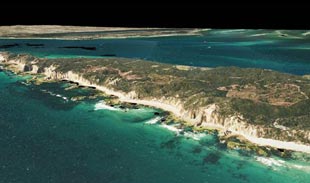
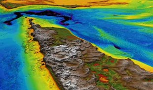
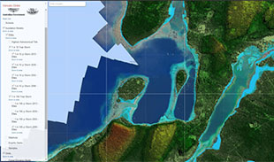
Sea-Level Rise (2012)
Coastal municipalities will be able to identify future impacts of climate change and sea level rise using new high resolution...

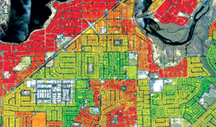
HealthTracks (2012)
HealthTracksTM demonstrates how spatial technology can improve the communication of complex statistical data by serving as a one-stop planning and...
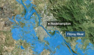
Disaster Response (2012)
CRCSI produced vital flood-mapping images for the national disaster response effort during the flooding in Jan-Feb 2011, using Italian Space...
43pl Collaboration
43pl recently stated a collective view that they now “have the skills and knowledge of how to interact with and...
Barista (2016)
An easy-to-use photogrammetric software system for generating spatial information products from satellite imagery, Barista has been tailored for 3D geo-positioning...
National Data Grid (2012)
NDG is a shared infrastructure that provides an economic and effective means to integrate SI from a variety of sources,...
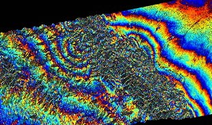
Sichuan Earthquake Response (2008)
Quick action by CRCSI researcher Professor Linlin Ge and his UNSW team provided vital real-time information on the Sichuan earthquake...
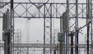
IndjiWatch through IIntegrate (2006)
For electrical network operators which have remote assets under threat from hazards, Indji Watch is continually monitoring assets, identifying threats...

Efficiency & Safety (2014)
CRCSI researchers have achieved fuel and safety gains through improved cornering control of aircraft during power line inspections, by developing...

Climate Monitoring (2014)
Economic, social, and environmental planning for a carbon-constrained future requires a capacity to monitor climate change impacts.

Woody Vegetation (2015)
Completed in May 2015, the Woody Vegetation Project produced tools and procedures to auto-general landscape level woody vegetation features.
Landsat Data Mining (2012)
The project developed the processes, the underpinning standards and infrastructure to standardise the information products from the Landsat Archive.
© 2024 CRCSI | Disclaimer | Privacy Policy